Vegetation structure: using photographs
Measuring Leaf Area Index (LAI): Hemispherical photography can be used in the field to measure leaf area index. Knowing the location of these field photos, they can be match up with image data for mapping LAI.
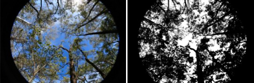
Field photographs taken with a fisheye lens and processed to distinguish plant projective cover from sky.
Both vegetation and geomorphic features identified in the field and be used in addition to GPS measurements to locate the position of field measurements, as shown below.
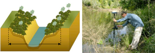
Illustration of riparian zone with abrupt changes occurring in vegetation cover and bank slope along the external perimeter of the riparian zone
Differential GPS measurements for precise location of the water/land interface
Reference:
Johansen, K., Phinn, S., Lowry, J., and Douglas, D., 2008. Quantifying indicators of riparian condition in Australian tropical savannas: integrating high spatial resolution imagery and field survey data. International Journal of Remote Sensing. Vol. 29, No. 3, pp. 7003-7028.