Inverse modelling
This approach is really a two stage process:
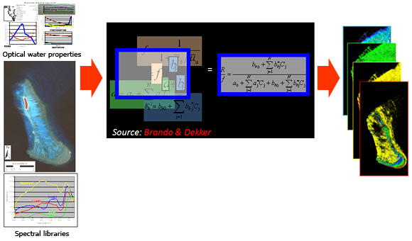
Stage one uses one of several possible inverse models to estimate the water depth, water column constituent concentration and benthic reflectance signature of each image pixel.
Stage two can use any of the previously outlined supervised or unsupervised approaches to map benthic cover features.
Another modified form of this approach is to forward model the spectral reflectance signatures from all possible combinations of : water depth, water column constituent concentration and benthic reflectance signatures, to create a look-up table that can be used to classify each pixel (Hedley et al. 2009).
Requires baseline field data:
Reference:
Hedley, J., C. Roelfsema and S. R. Phinn (2009). "Efficient radiative transfer model inversion for remote sensing applications." Remote Sensing of Environment 113(11): 2527-2532.
Brando, V. E., J. M. Anstee, M. Wettle, A. G. Dekker, S. R. Phinn and C. Roelfsema (2009). "A physics based retrieval and quality assessment of bathymetry from suboptimal hyperspectral data." Remote Sensing of Environment 113(4): 755-770.
Brando, V. and A. Dekker (2003). "Satellite hyperspectral remote sensing for estimating estuarine and coastal water quality." IEEE Transactions on Geosciences and Remote Sensing 41(6): 1378-1387.