Groundcover field data sources
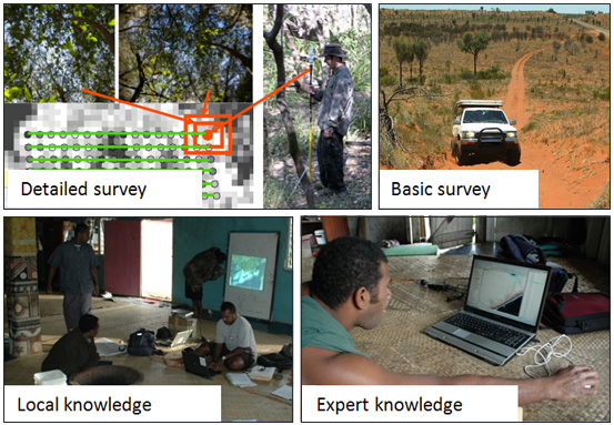
Detailed field data: transect surveys or differential GPS surveys
Basic field data: driving surveys
Local community knowledge: local community members interpret a satellite image. The image is projected on white paper, so areas with known ground cover can be manually delineated and labelled by the community members. For example, the community members can be represented by local farmers who are knowledgeable on the groundcover composition, since they visit the study area on a regular basis.
Local expert knowledge: Local experts that are assumed to be knowledgeable about the study areas due to their regular visits over several years. Based on that, the experts assigned mapping categories to randomly distributed sample points, which were overlaid on the satellite image.