Changes in river width
Tasselled Cap Transformation used for identification of change in vegetation cover between two different images.
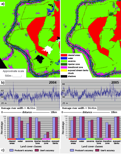
Measuring change in river width, Daly River, Northern Territory:
a) Two classified QuickBird images for an area along the Daly River, Northern Territory.
b) Graphs showing variation in river width between the two QuickBird images captured one year apart (2004-2005).
c) Classification accuracy assessment of the land cover maps.
a) Two classified QuickBird images for an area along the Daly River, Northern Territory.
b) Graphs showing variation in river width between the two QuickBird images captured one year apart (2004-2005).
c) Classification accuracy assessment of the land cover maps.