Changes in canopy cover
The following images illustrate the detection of a change in canopy cover between August 2004 and August 2005 along the Daly River, Northern Territory, Australia.
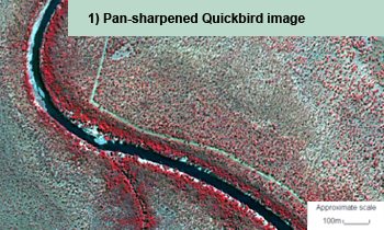
Pan-sharpened QuickBird image showing parts of the Daly River, Northern Territory.
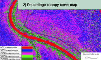
Map of plant projective cover based on models developed using field and image derived information on canopy cover.
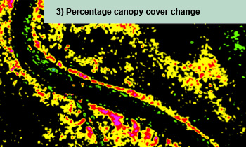
Change map with yellow and red colours indicating a decrease in canopy cover and green colours indicator an increase in canopy cover between August 2004 and August 2005 along the Daly River.
Reference:
Johansen, K., Phinn, S., Lowry, J., and Douglas, D., 2008. Quantifying indicators of riparian condition in Australian tropical savannas: integrating high spatial resolution imagery and field survey data. International Journal of Remote Sensing. Vol. 29, No. 3, pp. 7003-7028.