Changes in foliage projective cover
Mapping foliage projective cover (FPC) using Landsat TM imagery in the Barakula State Forest.
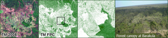
Mapping foliage projective cover: a) Landsat TM imagery Barakula State Forest, b) foliage projective cover , c) close-up of foliage projective cover, and d) Barakula forest from plane.
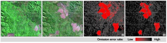
Mapping the probability change in vegetation cover for two Landsat TM images for the Barakula State Forest.