Georeferenced photo transects - photo analysis
Coral Point Count excel (Kohler et al. 2006) can be used to quantify benthic abundance and composition. The software provides a user interface which can be used to distribute (e.g. random or in grid) 1- x number of points on a photo. Each point will be assigned manually to a specific category. The category is part of a hierarchical structure that needs to be determined before the analysis starts and can vary depending on the management question asked.
For example ,with habitat mapping two approaches have been used:
- Benthic cover type (e.g. coral or seagrass species, sand, turf, etc) assigned to 24 points for each photo
- Benthic composition (e.g. coral dominant, Seagrass with sand, Rock with Rubble) assigned to 1 point representing the whole photo.
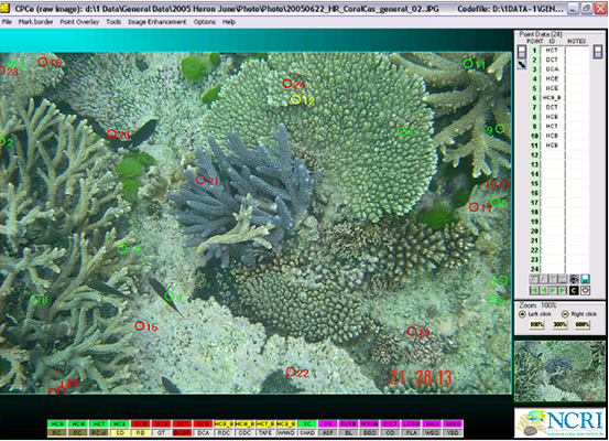
Screen shot of Coral Point Count excel (Kohler et al. 2006).