Evaluating field survey techniques
Several methods can be used to determine benthic abundance and composition, however for calibration and validation of remote sensing imagery, it is crucial that the GPS position of the benthic information is known so it can be compared with other spatial data (See also geometric correction).
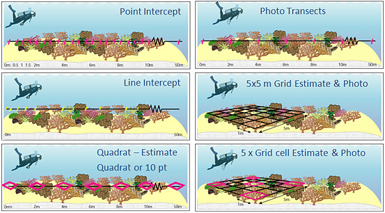
Field survey techniques: Insert caption here.
Reference:
Roelfsema, C., Phinn S.R. and Joyce K.E. (2006) Evaluating benthic survey techniques for validating maps of coral reefs derived from remotely sensed images. Proceedings 10th International Coral Reef Symposium. Okinawa.