Features mapping
When features are visible in the field and images, feature mapping can provide additional information for calibration and validation and georeferencing.
These feature could be large bleached patches of coral, or a rubble area (as shown below)
For feature mapping , the edge of the feature will be recorded while swimming/or driving a boat, the extent and having a GPS logging the GPS position at set interval.
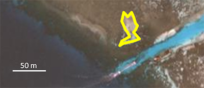
Example of rubble area mapped within live coral area in coral reef.