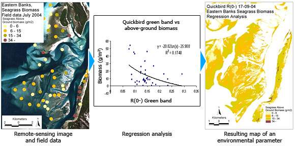
Regression (empirical) analyses
Values of the environmental parameter to be mapped are collected and corresponding pixel values from the remote sensing image are derived at the field data location. Regression analysis is then used to develop an inverse equation for estimating the environmental parameter value from each pixel value in one or more image bands. This approach is based on the assumption that the environmental value to be mapped has a causal relationship with the amount of sunlight reflected or absorbed in a specific image band or bands.
Reference:
Phinn, S. R., C. M. Roelfsema, V. E. Brando, A. G. Dekker and J. M. Anstee (2007). "Mapping Seagrass Species, Cover and Biomass in Shallow Waters: An Assessment of Satellite Multi-spectral and Airborne Hyper-spectral Imaging Systems in Moreton Bay (Australia)." Remote Sensing of Environment (Special Issue on Earth Observation for Biodiversity and Ecology).