Manual delineation
Areas with similar colour and texture are manually delineated as polygons and then assigned a mapping category based on the field data.
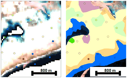
Field data + image backdrop
Delineated habitat map
Areas with similar colour and texture are manually delineated as polygons and then assigned a mapping category based on the field data.
Acknowledgements | Terms of Use | Feedback
Authorised by: Head of School
Maintained by: sees.rsrc_rstoolkit@uq.edu.au
ABN 63 942 912 684
CRICOS Provider No:00025B