Cyclone, coral bleaching, and coral recovery
St.Leu Reef, la Réunion: aerial photography and high spatial-resolution satellite images
Saint-Leu Reef, la Reunion, Indian Ocean was affected by two major cyclones and a major bleaching event in the last decades. A 35-year time series of coral community maps was obtained from visual analysis and manual delineation of patterns identified on the time series of high spatial resolution images. Both time series highlight the impact of the successive disturbances that affected the reef across the decades and cycles of coral degradation and coral recovery were retraced from the maps.
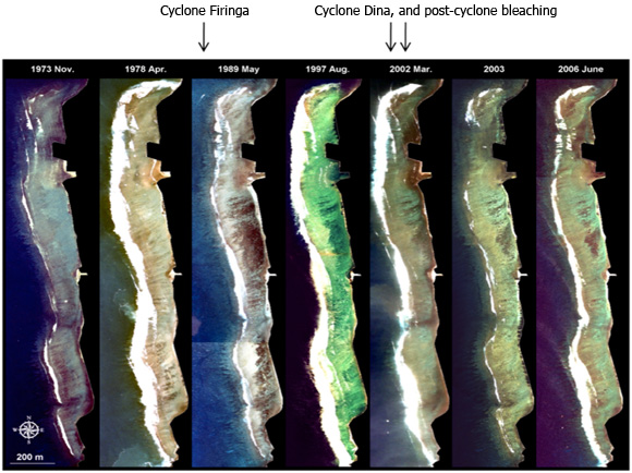
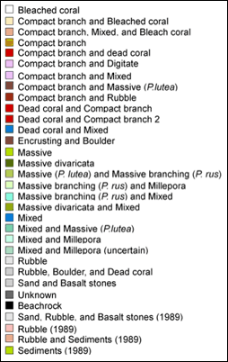
Multi-temporal series (1973 to 2006) of coral community maps on Saint-Leu Reef obtained from the images presented above. Coral communities were mapped on all images using manual delineation of polygons identified according to colour and texture contrasts on the images presented above. The maximum breaking wave zone is masked in white. Succession of degradation and recovery phases in response to the cyclones (1989, 2002) and bleaching event (2002) are highlighted below the maps for illustration only, with no indication of scale.
Reference:
Scopélitits J., Andréfouët S., Phinn S., Chabanet P., Naim O. , Tourrand C., Done T. (2009) 35 years of coral community change on Saint-Leu Reef (la Réunion, Indian Ocean) from in situ and remote sensing assessment. Estuarine and Coastal Shelf Science, 84: 342-352.