How do I use the graphic sequence?
This sequence links the environmental variable to be mapped and the type of environment to suitable data sets and processing techniques.
The toolkit provides two options for obtaining this information. The first is to select the particular environmental feature you are interested in mapping and monitoring, in order to find the most appropriate remote sensing approach for your needs. The second option is to choose a specific remote sensing approach, and to explore potential applications for mapping and monitoring in terrestrial environments using your chosen sensor type.
| Option 1: Select environmental feature |
|
Option 2: Select sensor type |
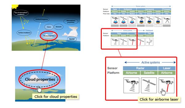
| A) First, click on the aspect of the atmospheric environment you are interested in mapping or monitoring (e.g. cloud properties). |
|
A) First, select the remote sensing platform/sensor combination you are interested in (e.g. airborne digital photography). |
| B) Next, click on the labelled icons until you reach the specific environmental parameter you are interested in (e.g. cloud top temperature). |
|
B) For your chosen sensor type, click through the table to explore the feasibility of potential mapping or monitoring applications. |
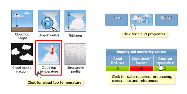
| C) The final page shows the sensor and platform types available for mapping or monitoring your chosen environmental variable (see below). You can click on these icons for more information. |
|
C) Click on any table header (see above) to download a pdf document with more information on data and processing requirements, constraints and references for your chosen application. |
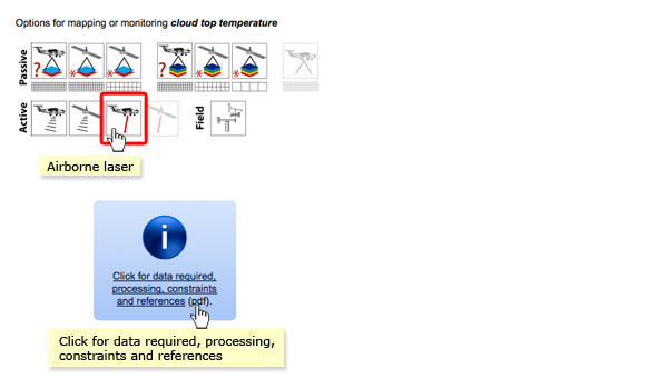
| D) Click on the 'information' icon to download a pdf document with more information on the data and processing requirements, constraints and references for your chosen application. |
|
|