|
Title |
Author |
Brief description of content |
Link |
|
Regional Fuel
Mapping Using
an Object-Oriented Classification of Quickbird Imagery
|
Lara A Arroyo (CRSSIS) |
It shows a
methodology to map Prometheus fuel type from remote sensing data at a
high spatial resolution. It includes a brief description of the
Prometheus fuel classification, the QuickBird sensor and the
differences between Pixel-Based and Object-Oriented approaches.
|
 |
Introduction to
Object Oriented analysis
|
Lara A Arroyo (CRSSIS) |
It presents some of the limitations
of pixel-based analysis, the main characteristics of the
object-oriented approach and one example showing the use of a
hierarchical network.
|
 |
|
|
Kasper Johansen (CRSSIS) |
It analyses different change
detection techniques (image differencing, image regression, and
post-classification comparison), all of them on a object-oriented
environment.
|
 |
|
|
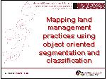
Dan Tindall (NRW)
|
Evaluation of fuzzy classification,
decision tree/expert systems and ensemble (machine) learning
approaches for classification of a land management practice (contour
banks) using data derived from object-oriented segmentation of SPOT
panchromatic imagery.
|
 |
Burnt Area
Mapping
|
Dan Tindall (NRW) |
Examples of object-oriented
classification approaches to burnt area mapping in Australia
|
 |
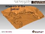
Where
are the gullies? |
Alisa Eustace (NRW) |
Delineating gullies from LiDAR
within the Fitzroy Catchment using a semi-automated object-oriented
classification approach
|
 |
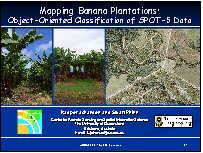
Mapping Banana Plantations: Object-Oriented Classification of SPOT-5 Data
|
Kasper Johansen (CRSSIS) |
The
objective of this research was to develop and evaluate an approach for
object oriented mapping of banana plantations from SPOT-5 multispectral
and panchromatic image dataineating gullies from LiDAR within the
Fitzroy Catchment using a semi-automated object-oriented classification approach.
|
 |
| The Joint Remote Sensing Research Program. Object Based Image Mapping Activities |
Lara A Arroyo (CRSSIS) |
It
summarizes the research projects that are currently being
developed in the Joint Remote Sensing Research Program using
definiens/eCognition.
|
 |
Object Based Image
Analysis at CDU |
Guy Boggs (CDU) |
It
summarizes the research projects that are currently being
developed in the NT using
definiens/eCognition.
|
 |
